0
C-MAP NA-M022 SD CARD FORMAT US EAST COAST AND THE BAHAMAS
$279.00
C-MAP MAX NA-M022 – U.S. East Coast & The Bahamas – SD™ Card
Description
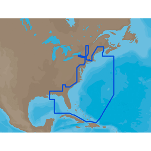
NA-M022 => USA East Coast and Bahamas
Coverage of the United States Atlantic coast from Passamaquoddy Bay, ME down to Key West, FL, with extended coverage into the Gulf of Mexico over to Perdido Bay, FL. Includes coverage of Bermuda and all of the Bahamas. Also includes coverage of the Hudson River, Lake Champlain, Erie Barge Canal, Savannah River, St John’s River and Okeechobee Waterway. Caribbean coverage includes charts from Explorer Chartbooks and Wavey Line PublisingThis product may not be returned to the original point of purchase. Please contact the manufacturer directly with any issues or concerns.
Additional information
| Weight | 0.1 lbs |
|---|---|
| Dimensions | 10 × 6 × 1 in |
Only logged in customers who have purchased this product may leave a review.
Related products
-

C-MAP SA-M500 SD CARD FORMAT COSTA RICA – CHILE FALKLANDS
$279.00 Add to cart -
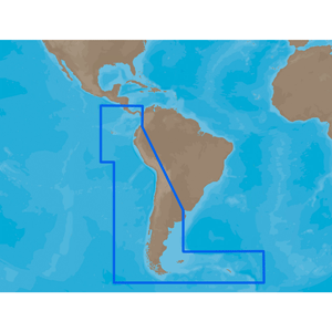
C-MAP SA-M500 C-CARD FORMAT COSTA RICA CHILE FALKLANDS
$279.00 Add to cart -
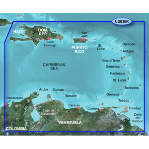
GARMIN BLUECHART G3 HXUS030R SOUTHEAST CARIBBEAN MICROSD
$149.99 Add to cart -

C-MAP NA-M022 C-CARD FORMAT U.S.EAST COAST AND THE BAHAMAS
$279.00 Add to cart
Reviews
There are no reviews yet.